Geographic Data
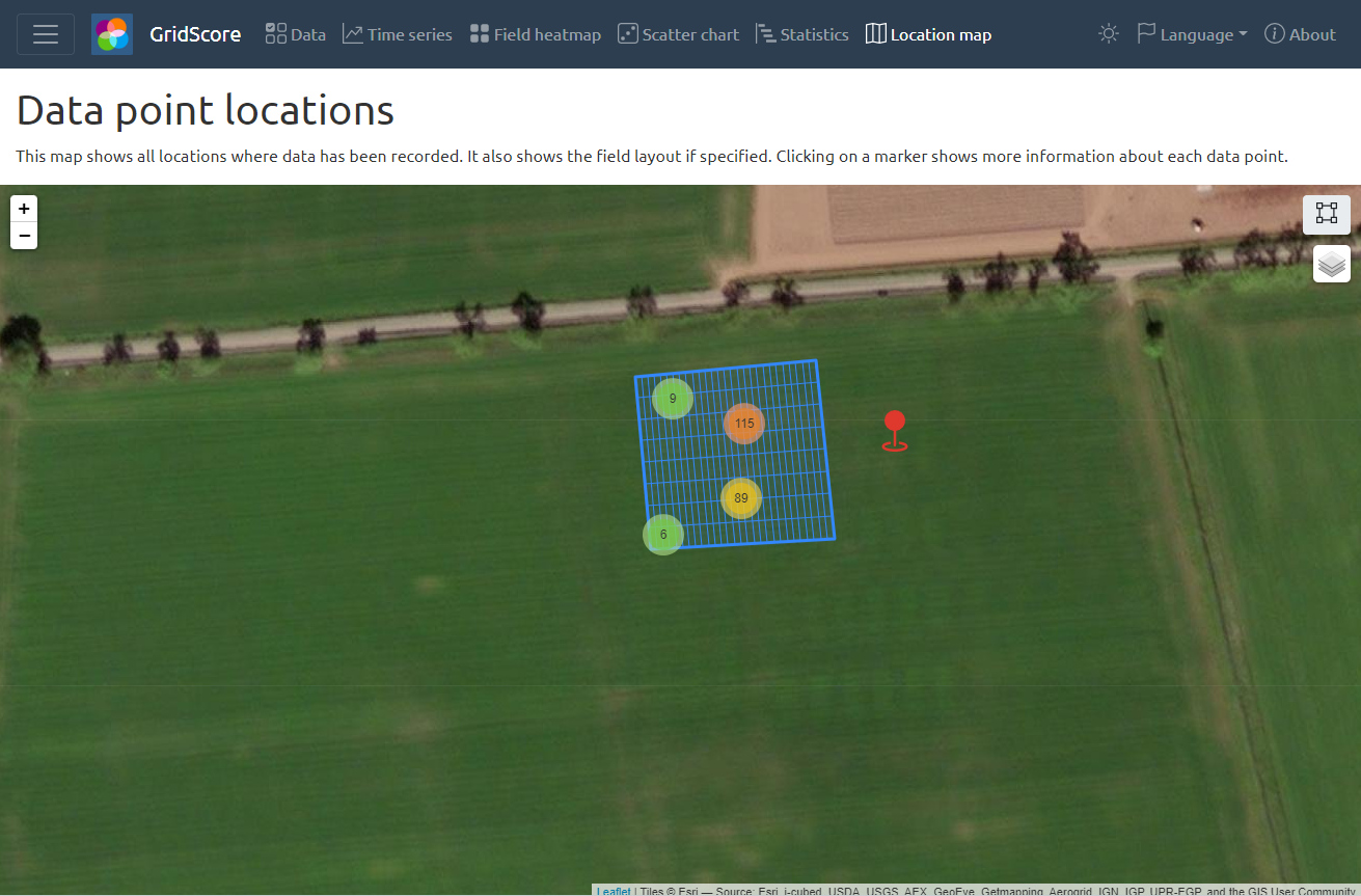
GridScore stores geographic information, where available, on the trial location, GPS coordinates of data recording events and the data collection device’s location. All of these pieces of information are shown on the location map within GridScore. If the corner points of the trial have been specified, GridScore will use that information together with the number of rows and columns to visualize the field plan on the map. If enabled, each plant/plot has a GPS coordinate associated with it which corresponds to the location of the last data recording event for this cell. A marker is shown on the map for each cell in the trial that has GPS information.
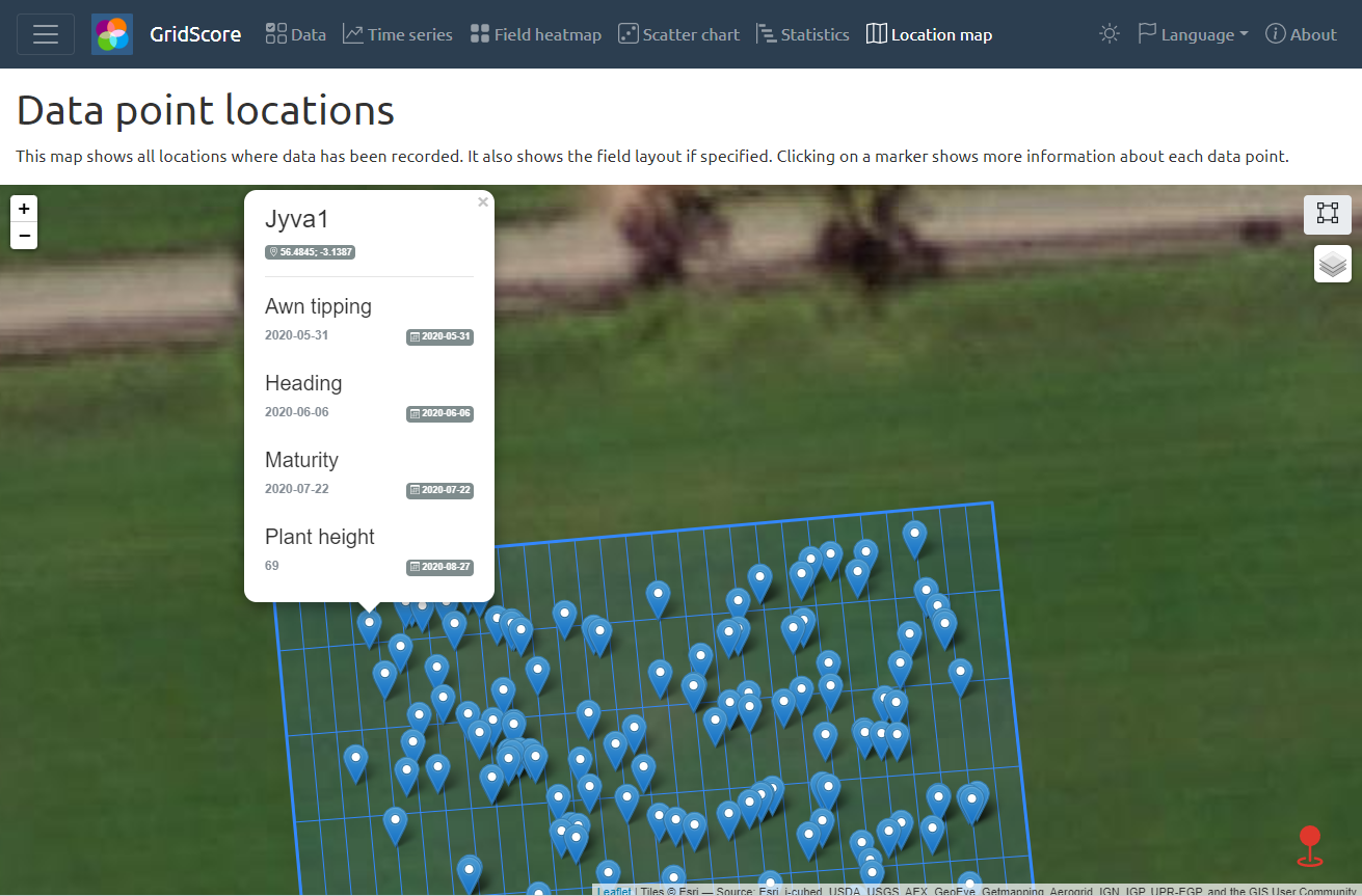
Clicking on one of the markers shows the data recorded for this plant/plot in a popup.
The current position of the user is highlighted both on the location map as well as the main data view. Depending on the strength and accuracy of the GPS signal, this will give you a more or less accurate idea of where you are currently standing in relation to the trial. Both views update the user position as you move around the trial.
Changing trial corner points and markers
You can change the trial corner points and markers as defined in the Trial Setup step by clicking on the icon in the top right corner of the map. This opens a modal dialog where you can change the settings and then save your updates.